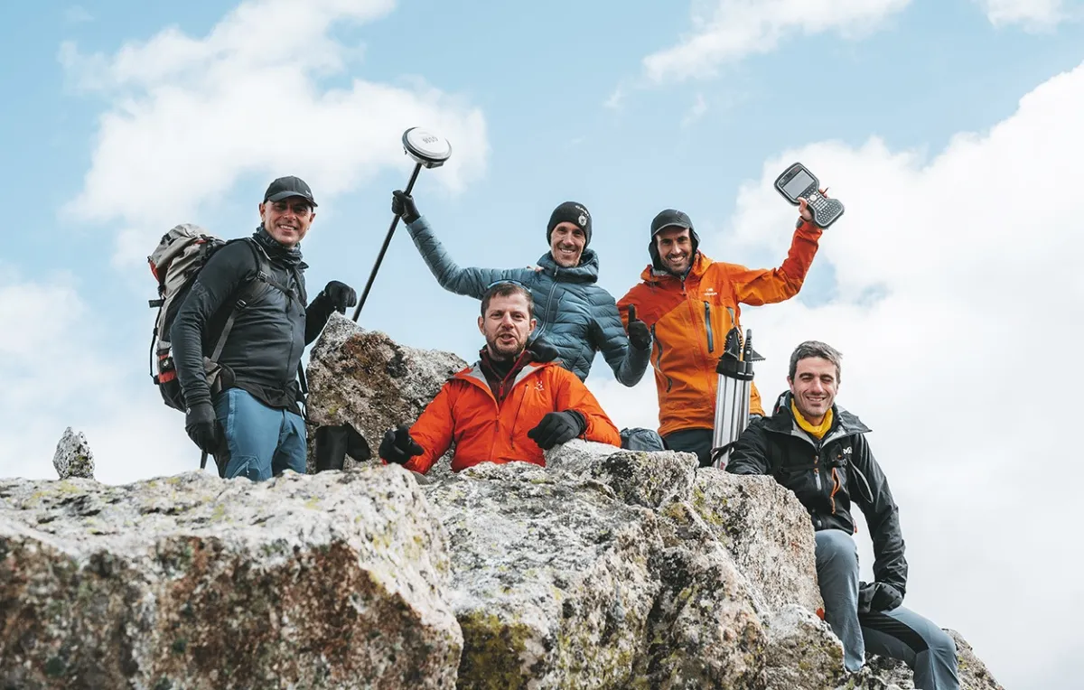
The preparation of a definitive census of peaks over 3000 meters has been a source of interest for people and administrations linked to the Pyrenees for decades. As part of the cycle of free conferences and talks at the Base Camp that accompanies the celebration of the Festival, on Friday the 21st we welcomed the members of Sostremetries, an initiative born from the confluence of two passions: the mountains and topography. The group, formed as an association and made up of five topography professionals, aims to disseminate their profession by updating decades of measurements that have been left behind due to technological and methodological advances or other considerations unrelated to topography itself. Part of their work is obviously done on the ground on the peaks themselves, satisfying this mountain passion, with high-precision tools to obtain thousands of data that are sorted and interpreted to draw their conclusions.
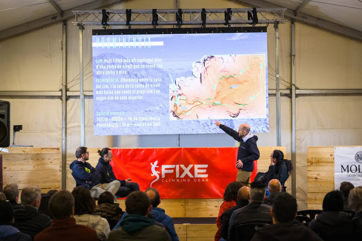
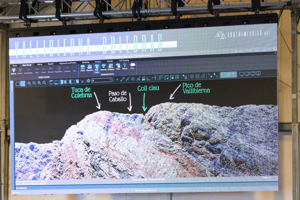
At the Festival they presented the recent results of one of their ongoing projects, The Pyrenean 3000ers, the first list created with precision topographic means, such as LIDAR, an optical remote sensing technology for measuring distances, in the style of radar or sonar, but using light. A project that is reverberating in the media, public administrations and mountaineers, of which they presented the methodology and criteria they follow to carry it out, and the work behind the headlines. A master class for the uninitiated and a refresher for those who are not unfamiliar with concepts such as “prominence”. This, which is the minimum difference in altitude that must be descended from a peak to reach any other peak of higher elevation, and set at a minimum of 10 meters in the 1990s —a fact not without debate— is not the only, but it is the key criterion, to determine what a peak is. From here, we learned about the exclusion of “false peaks” such as Pico Maldito and Tuca de Culebras, or the “ascension” of two new “invisible” peaks in the three-thousander category. A task with which they also identify the passes on which the concept of prominence is based, correct errors and specify the measured height of each peak they visit, with this high-precision system that reduces the old disparities of meters to centimeters or millimeters.
The Pyrenean 3000ers project continues with the review of some 85 peaks over 3000 meters in the Pyrenees during 2025 and next year, which beyond what is strictly measurable, suggests debates, both within the topographic community itself and, conversely from other areas, around the quantification of prominence —different in each mountain system— and how this ends up including more or less peaks, some with a social and historical background, in an environment that can benefit from their presence beyond strictly topographic criteria.
You can stay up to date and follow their developments at https://www.instagram.com/sostremetries